The Col de Turini is a legendary stage in the Monte Carlo Rally, with massive crowds gathering on its peak, often in the cold and snow. Starting at Sospel, the stage comprises 35 kilometres of demonic, twisting asphalt leading to La Bollène-Vésubie and taking in the 1607 metres summit. The stage was often run after dark and became known as the Night of the long knives, getting its name from the lights of the cars cutting through the trees and slits in the walls as they hurtled up or down the pass.
The Monte Carlo rally was designed to promote Monaco as a tourist destination, which seems to have worked quite well going by the amount of people in the principality. The Turini, though, on this sunny April day is quiet as a mouse. A choice of routes lead from Monte Carlo to Sospel, the quickest taking around 40 minutes. Sospel is the largest city in the valley of Bévéra but it’s far from the high life of Monaco. It’s possible to grab a coffee and panini before the onward drive if your timing is in sync with the locals' eating habits.
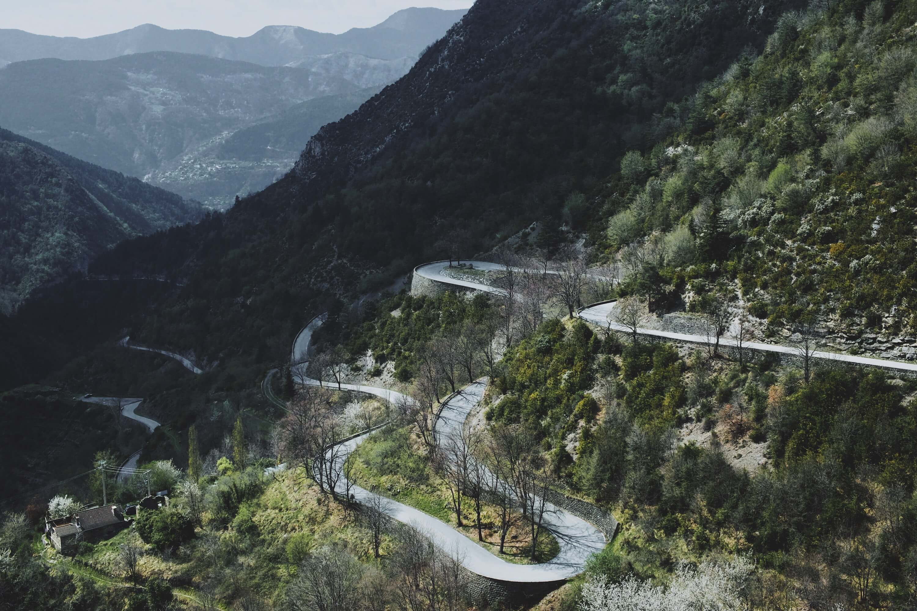
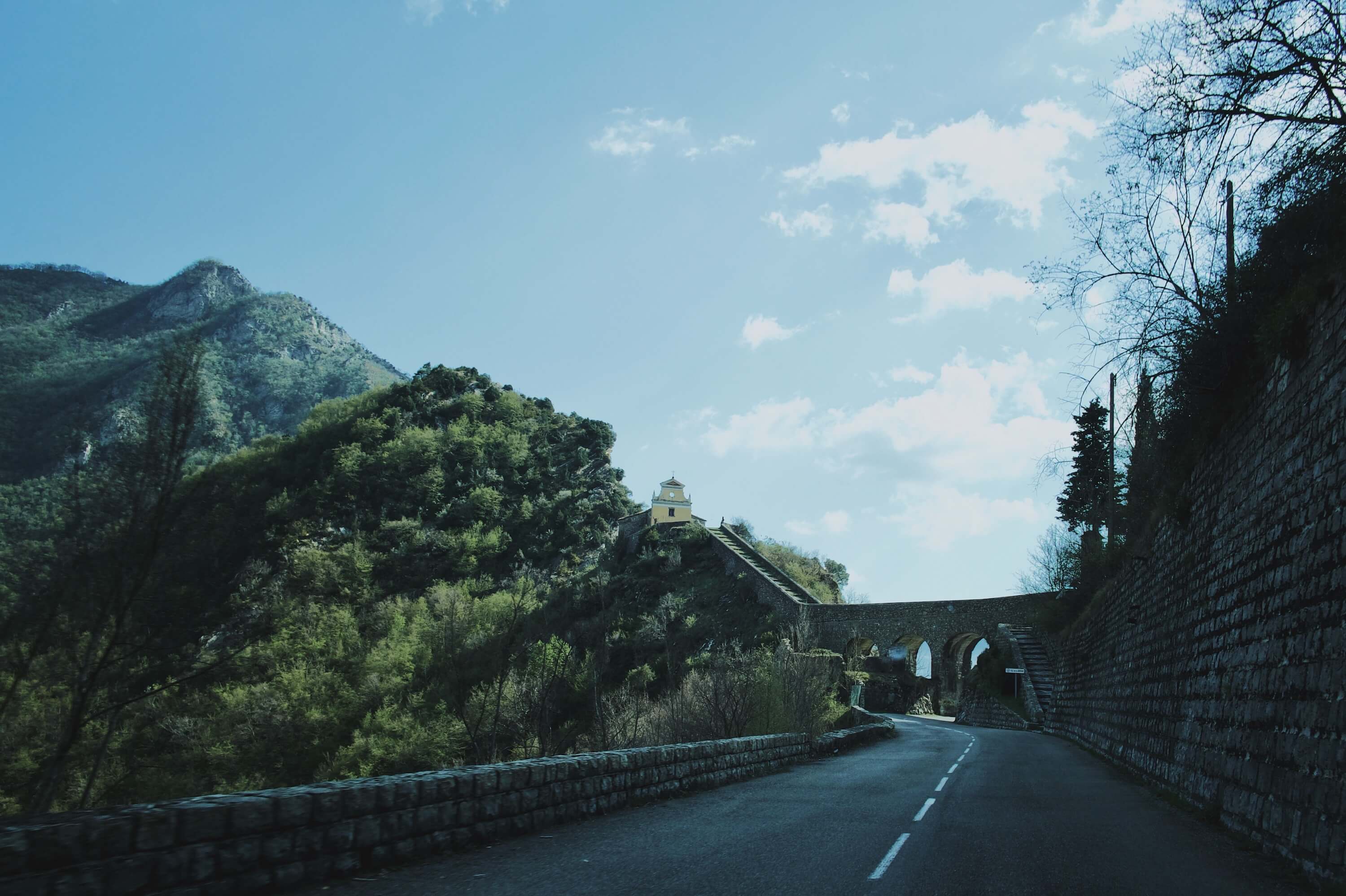
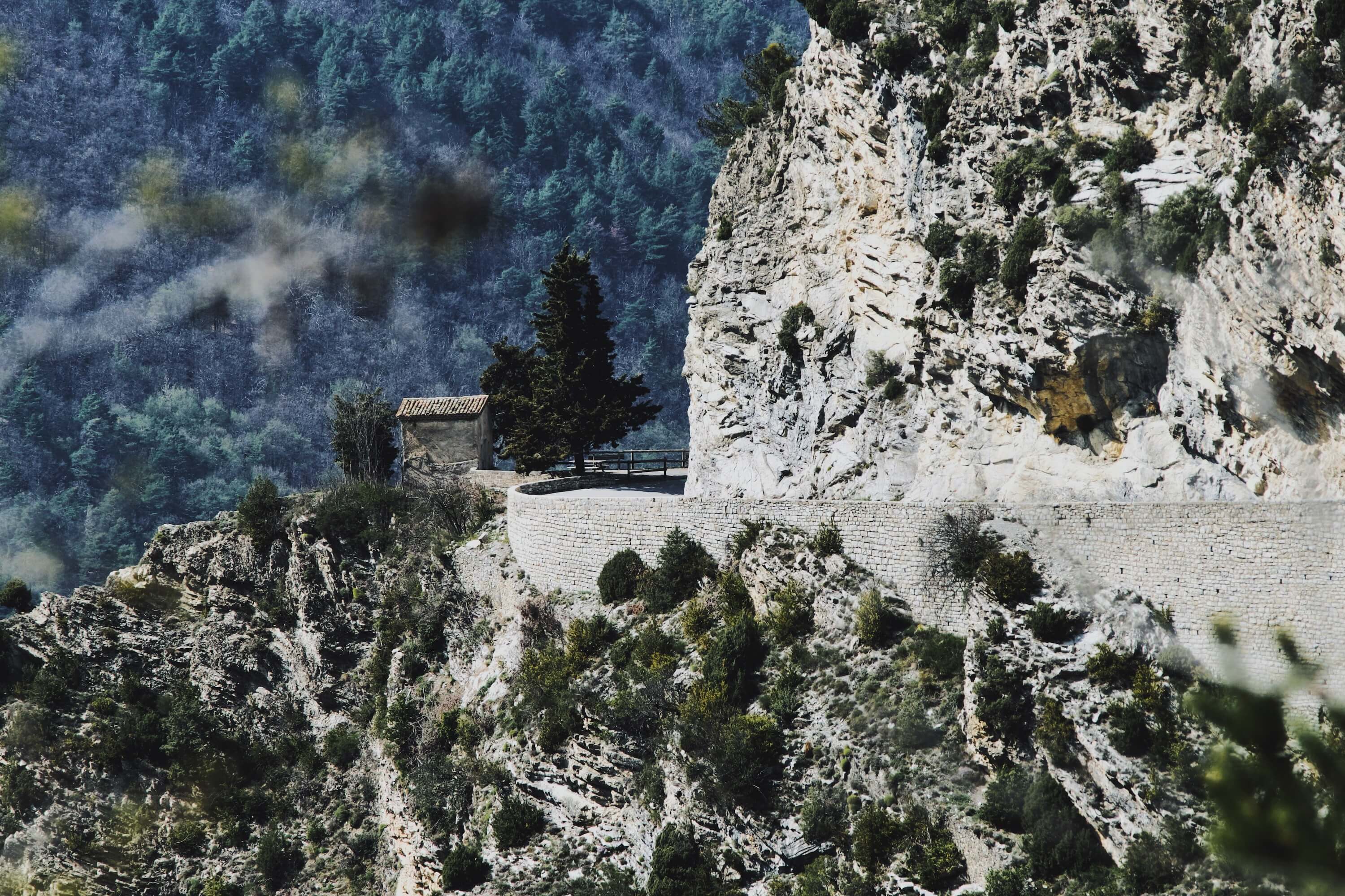
Heading out of Sospel on the D2566, villages soon become spartan and speeds start to rise. The first bends of note appear as we enter the Gorges of Piaon, steep-sided rocky walls tight to each side of the road. Crossing the gorges is a 42-meter bridge accessed by a long ramp that leads to the Notre-Dame de la Ménour chapel originally occupied by a Celtic tribe until the Romans came along. Shortly after the chapel is the village of Moulinet – watch for the speed bumps on the exit. After Moulinet the road surface becomes more, well, rally-like. Suspension is now tested as the surface changes every few kilometres and the road twists and turns onwards and upwards.
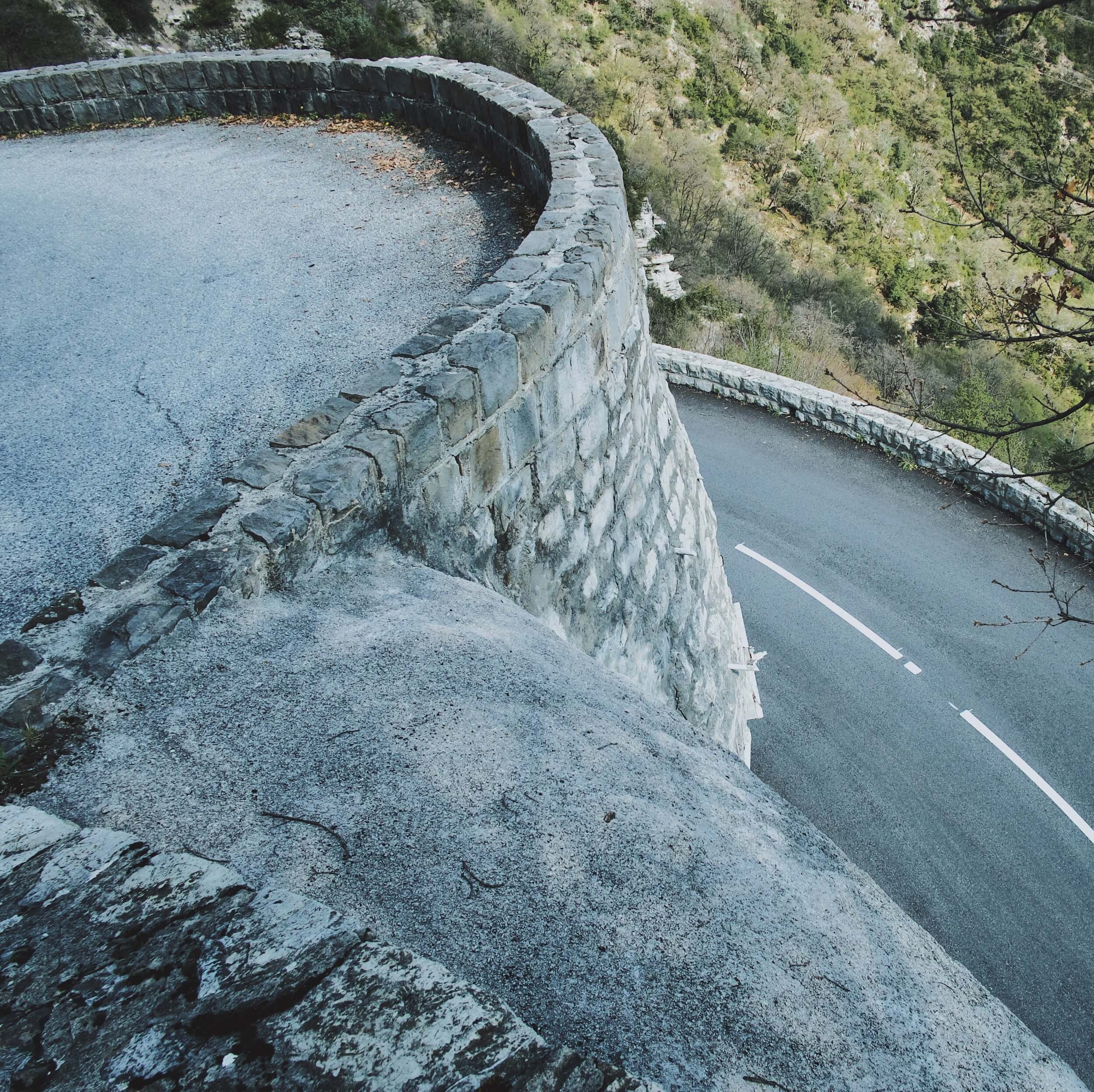
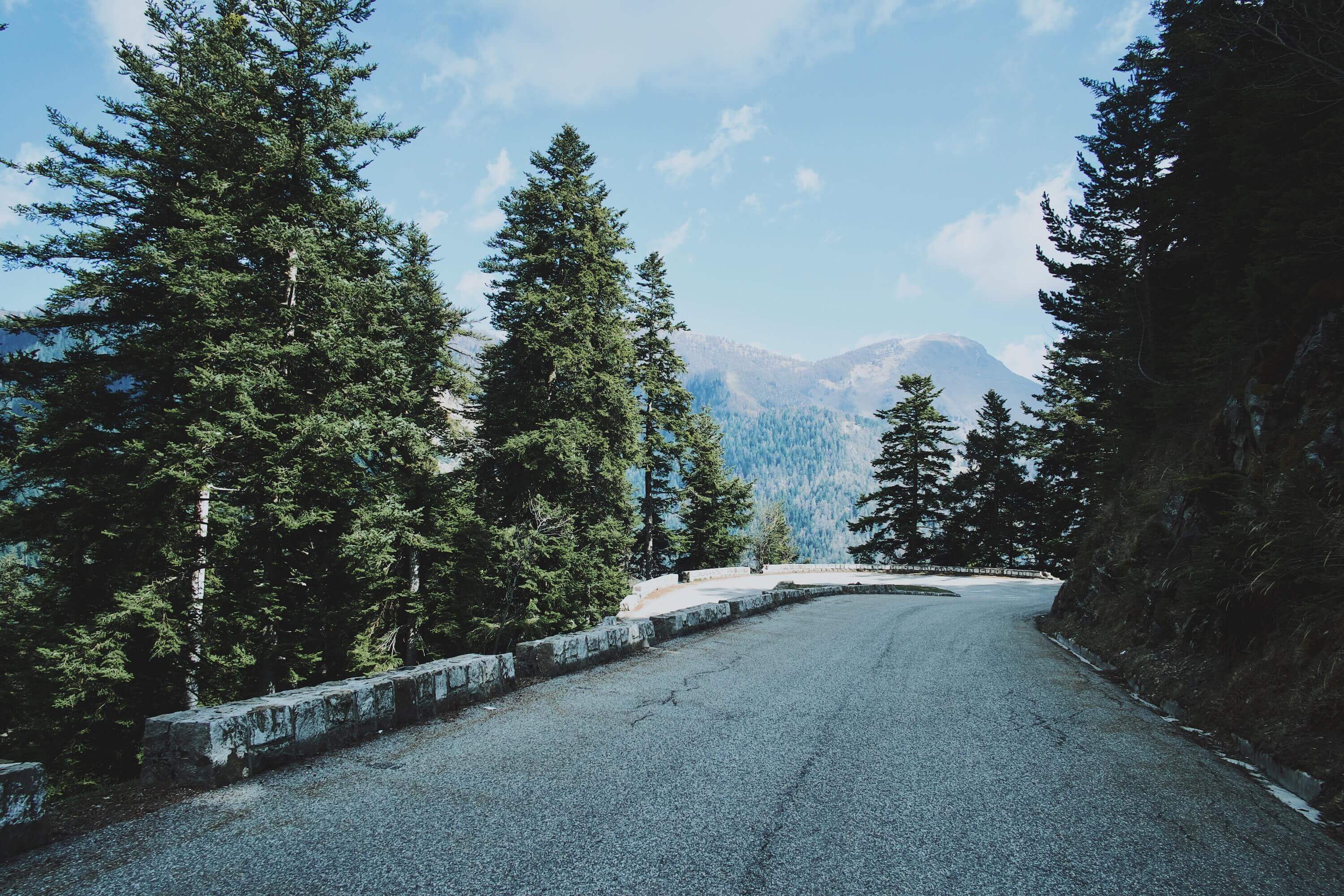
The Turini feels much more like a rally stage than the majority of alpine passes. It’s tight, bumpy and twisty with small walls and a big drop on one side, and cliffs on the other. It’s not a road designed for a Lamborghini Aventador or other wide-bodied supercar but there is plenty of evidence that some brave souls have sacrificed their bodywork on the asphalt. Some of the road surface chambers and angles are certainly worth watching out for.
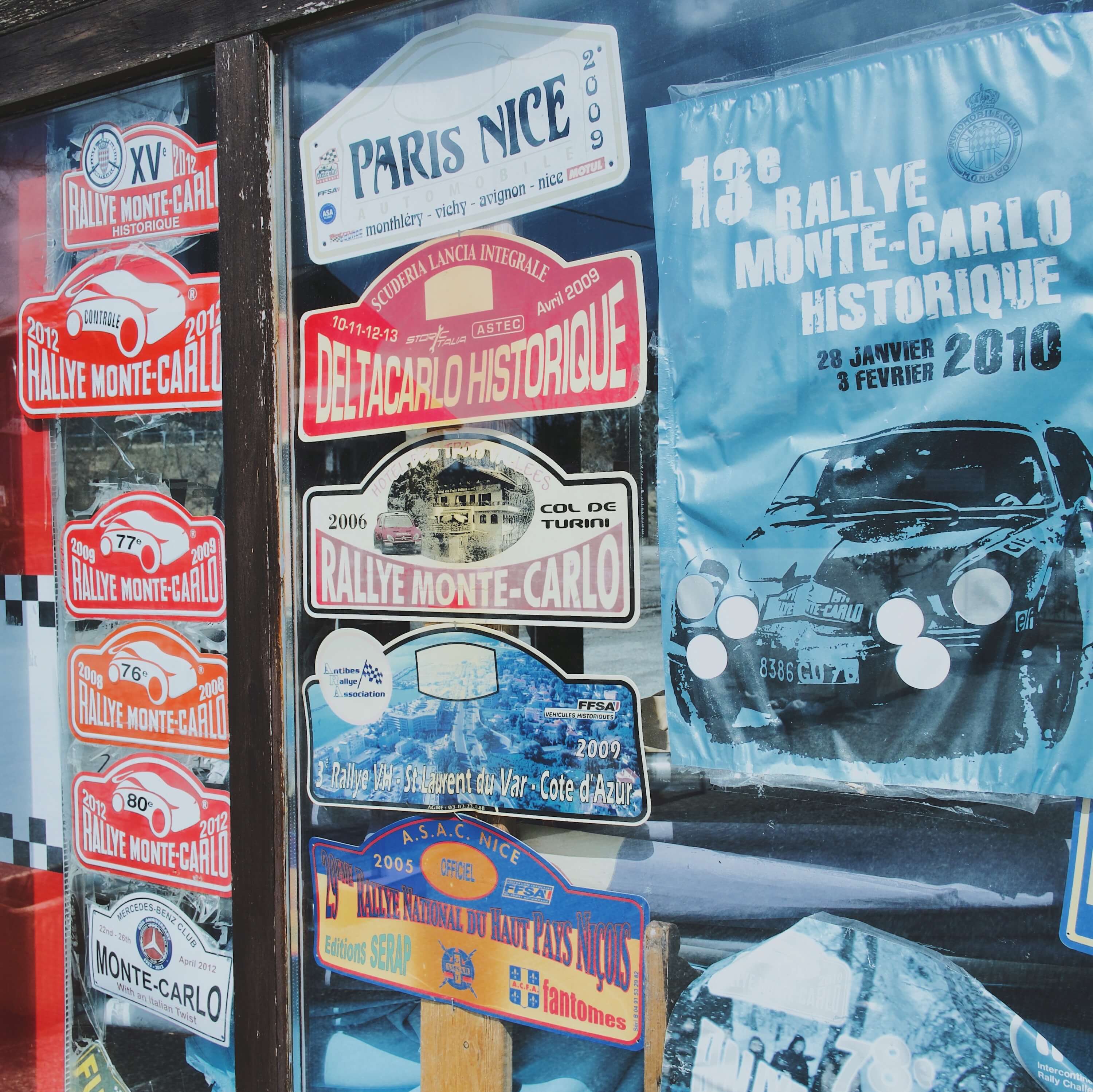
The road enters a pine forest nearing the summit, and cliffs and walls give way to equally unforgiving coniferous trees. At the top is some parking, an old ski lift and the Hôtel des Trois Vallées. Windows are covered with pictures of rally stars and old number plates but without the cheering crowds, snow and spinning of tyres there's not a lot happening. The summit doesn't even have a decent view.
Hitting the descent, we are now on the M70 and into fast, forested turns, hammering the brakes. We soon emerge from the pines into the classic alpes-maritimes scenery of rock walls, steep drops, ravines and of course, twisty asphalt. It isn't long though before La Bollène-Vésubie, a sleepy hamlet with stepped streets perched on a rocky outcrop appears. The Turini is unusual if you are used to the classic passes like the Furka pass. For a start, it’s quiet – at least in April – due to its remote location and lack of any major roads or towns. The road surface and tight nature make it different from the Swiss, if not the Italian passes and its lack of altitude robs it of a spectacular view from the top. But on this April day, following the mountains as they tumble back towards the coast, it's one of the best drives we can remember.
